Rain is in the forecast, pack the poncho
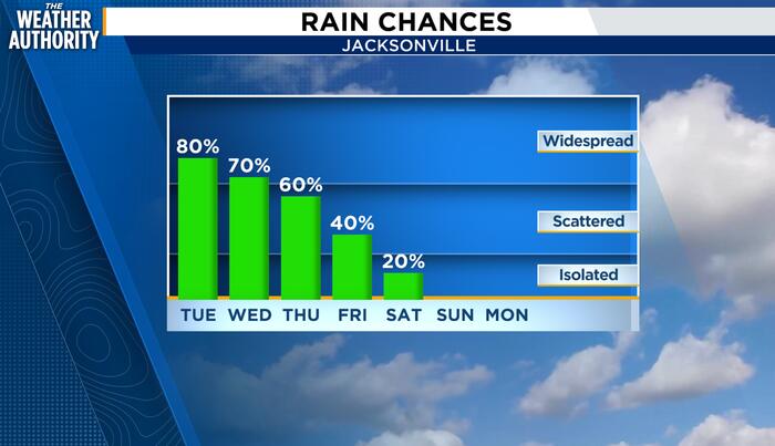
Local News Watching for flooding concerns over the next few days . (.) A prolonged stretch of wet, windy weather is setting up across Northeast Florida and Southeast Georgia, with heavy rainfall and localized flash flooding our biggest concerns through the end of the workweek. Showers will become more widespread throughout Tuesday, especially during the afternoon, with highs struggling to reach the lower 70s. Recommended Videos A strengthening northeasterly flow will keep conditions breezy, with wind gusts approaching 30 mph. Rain chances remain elevated Wednesday through Friday, generally between 70% and 80%, with periods of heavy rain and a few thunderstorms possible. The concern is not just how much rain falls, but how quickly it comes down. Locally, rainfall rates producing 1.5 to 1.75 inches in just one to two hours could prompt flood advisories, particularly in low-lying and poor-drainage areas. Persistent northeast winds will also increase the potential for tidal flooding, elevated water levels and beach erosion along our coast. We will need to closely monitor radar trends, rainfall rates and coastal conditions throughout the week. Temperatures will gradually climb into the middle 70s by Thursday and Friday, but unsettled conditions will continue into Saturday. The improving trend arrives Sunday, with decreasing rain chances, some sunshine returning and afternoon highs in the upper 70s. Monday looks relatively quiet as well, with partly sunny skies and highs in the middle 70s. Copyright 2026 by WJXT News4JAX - All rights reserved.